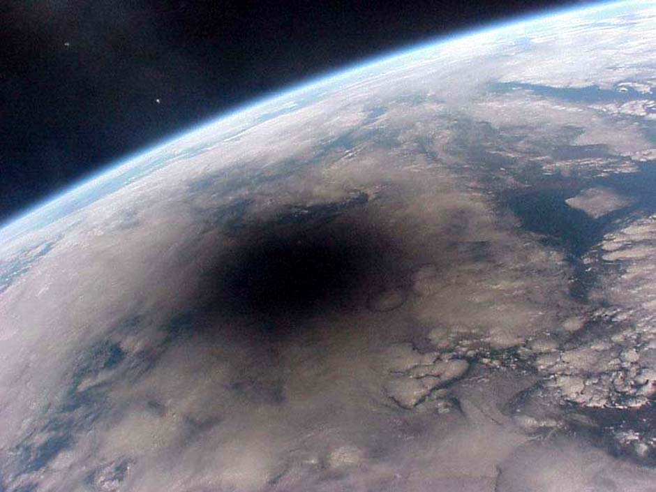
(Above) The shadow of the moon covers part of earth on August 11th, 1999 in this photo taken from Mir space station. This shadow
raced across earth at 2000 km/h, all areas under the centre of it plunged into darkness during a total solar eclipse. This was
apparently one the final photos taken from Mir.
|
Friends' Slides Collection: Set 013d: 11 Phenomenal images of earth
|
Set 013d: 11 Phenomenal images of earth received from 黃碧端 Pi-Twan Huang
|
Below are 11 incredible photos taken from space which illustrate just a few of earth’s fascinating geographical features and nature’s
frightening unpredictability
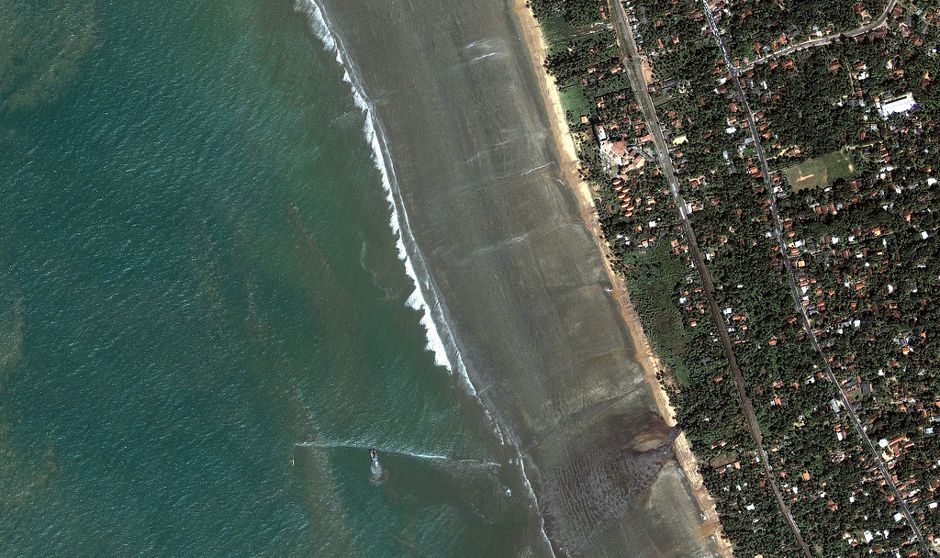
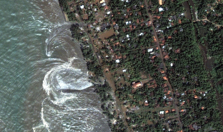
1. Sri Lankan coast, 26th December 2004
|
(Above) The ocean rapidly retreats 400 metres on the south-western coast of Sri Lanka, just 5 minutes prior to the arrival of a
devastating tsunami.
|
(Above) The swirling waters continue to batter the coast just moments after the main wall of water has hit.
|
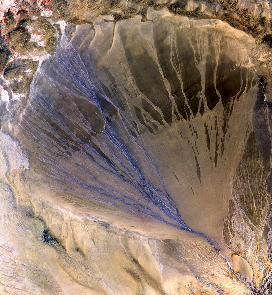
2. an alluvial fan, Xinjiang province, China
|
(Above) Covering an area 56.6 x 61.3 km and taken on May 2nd, 2002, this photo shows an alluvial fan that formed on the southern
border of the Taklimakan Desert in China. an alluvial fan usually forms as water leaves a canyon, each new stream eventually closing
up due to sediment - the result being a triangle of active and inactive channels. The blue ones on the left are currently active.
|
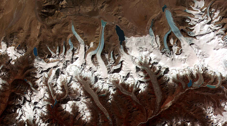
3. Retreating glaciers in the Bhutan-Himalaya
|
(Above) A beautiful but clear sign that glaciers are slowly melting due to global warming. Easily visible are the ends of most of these
glacial valleys’ surfaces turning to water to form lakes, a trend which has been noticed only in the last few decades.
|
4. Hurricane Isabel, 2003
|
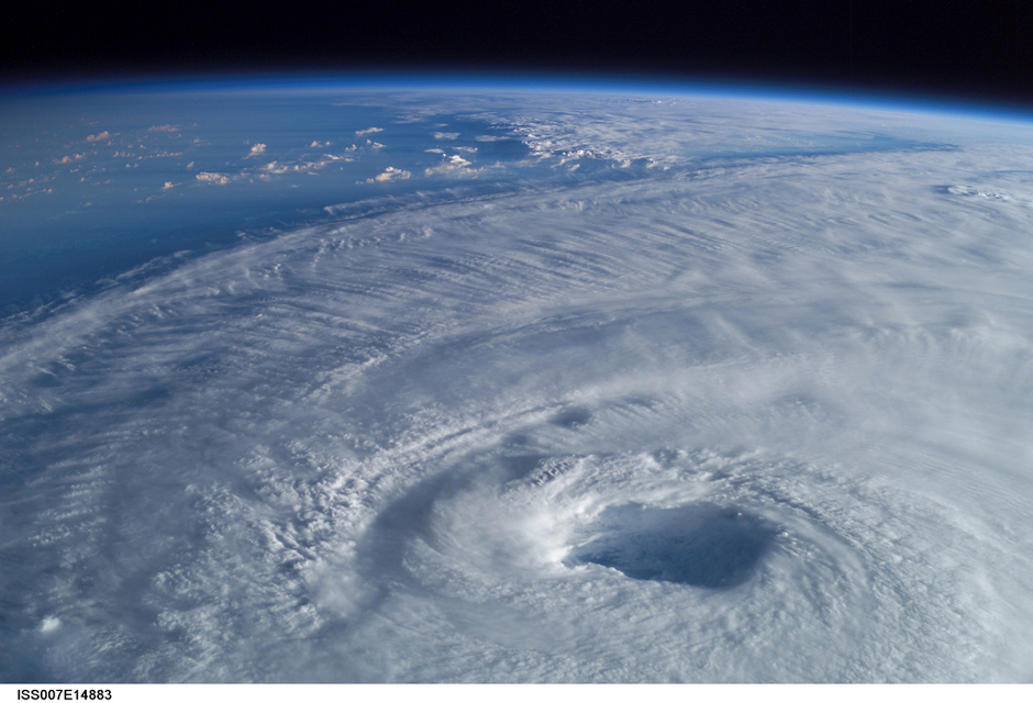
(Above) This terrifying photo of hurricane Isabel was taken on the international space station in 2003 and illustrates the immense size
of the hurricane’s eye. This particular hurricane was the deadliest of 2003 and winds reached 165 mph at its peak.
|
5. Greenland’s eastern coast, August 21st, 2003
|
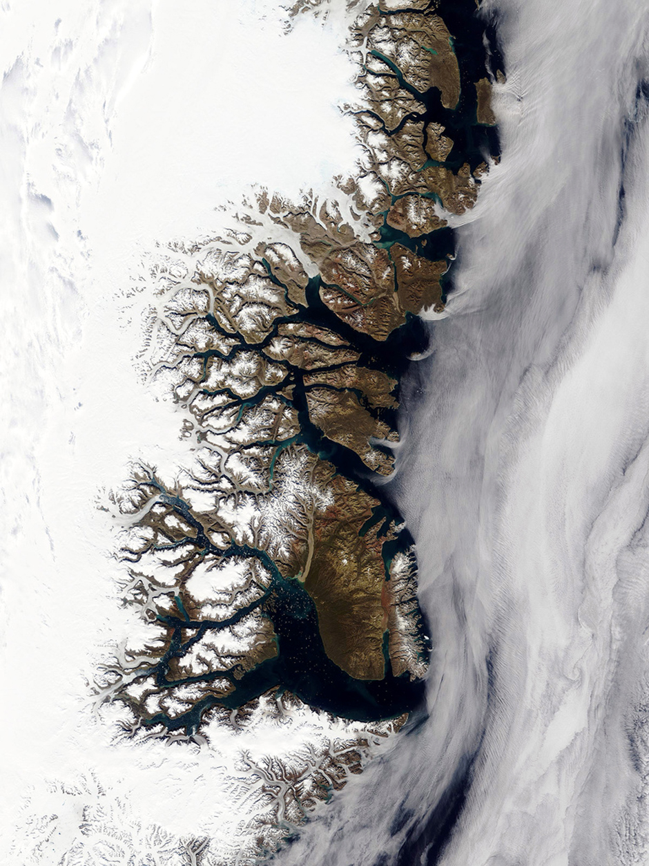
(Above) The fractal coastline of Greenland and its numerous fjords as seen from space.
‘little spots of white in the water seem to be ice originating from the deeper fjords that reach all the way to the icecap covering most
of the island.’ link
|
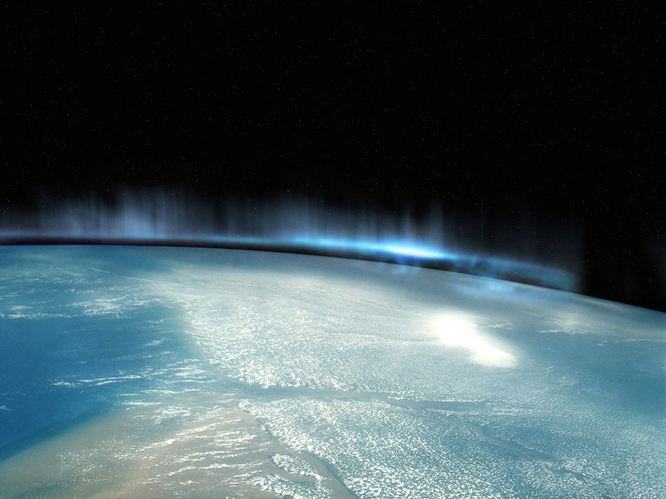
(Above) An astounding and spooky photo of the natural phenomenon known as aurora borealis, taken on-board space shuttle Atlantis
during the STS-117 mission.
|
7. A total solar eclipse from space, 1999
|
(Above) Mt. Egmont Volcano last erupted in 1755 and is now situated at the centre of Egmont National Park. Park regulations have
ensured the survival of a forest which extends at a 9.5 km radius from the summit of the volcano, the result of which can be seen
from space in the form of huge dark green disc. This photo was taken during the STS-110 mission, April 2002.
|
8. Egmont National Park, New Zealand
|
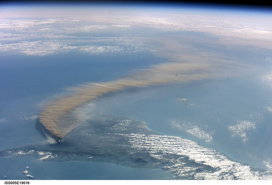
(Above) Taken from the international space station in 2001, this is a photo of a particularly violent eruption on the island of Sicily
which produced a cloud of ash that travelled as far as Libya. On the humongous version of the photo lighter coloured smoke can be
seen near the volcano - this was caused by lava igniting nearby forests.
|
9. Mt. Etna eruption, October 2001
|
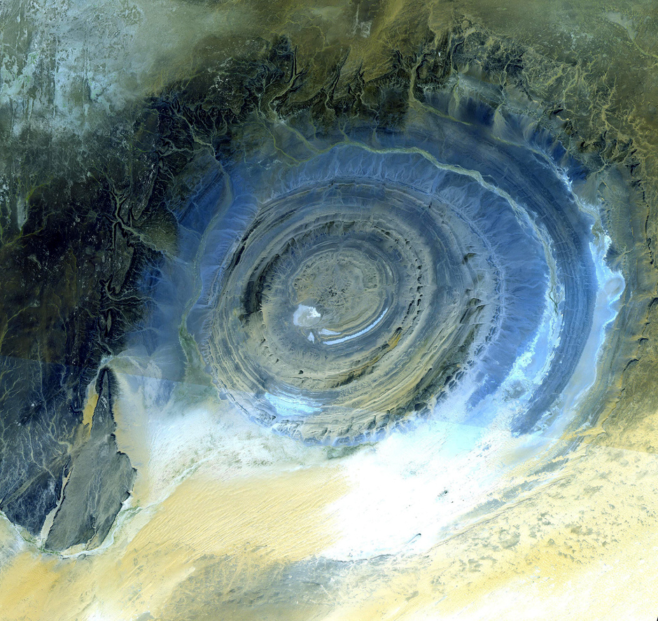
(Above) The cause of the richat structure in the Sahara Desert of Mauritania has been debated for many years. At first it was thought
to be a meteor impact crater due to its circularity but this has since been disproven due to the lack of shock-altered rock in its
vicinity. This massive (30 mile diameter) oddity is now believed to have been a rock dome sculpted over time by erosion. This
incredible image was taken by the advanced spaceborne thermal emission and reflection radiometer (Aster) on October 7th, 2000.
|
10. Richat structure, Mauritania
|